

If we are to protect the ocean, we must first understand how it works - and how it is affected by changes in the environment and climate. That’s why Statsraad Lehmkuhl is doing research as she sails the seas.
The transformation of Statsraad Lehmkuhl into a research platform began before the first One Ocean Expedition - the circumnavigation that lasted from 2021 to 2023. Equipment was installed that enabled the ship to collect data on temperature, oxygen levels, and ocean acidity, the amount of microplastics in the water, and the distribution of fish, marine mammals, and other organisms.
Holding back - at first
But not every wish on the scientists’ list could be fulfilled.
– We held back a little, explains Geir Pedersen.
A researcher at the Institute of Marine Research in Bergen, Pedersen leads the scientific committee of the expedition and has been responsible for planning and coordinating the research work carried on board.

– The ship received a great deal of useful scientific equipment, but going all the way would have required major investment and significant modifications to the vessel.
The first expedition demonstrated that doing research from a sailing ship worked very well. Based on that experience, the scientific committee proposed a more ambitious approach this time.
– We recommended making the necessary investments to install all the sensors we wanted, says Pedersen. Taking it one level further would bring the ship up to the standard of modern research vessels.
Some equipment was replaced, new instruments installed, and operational and analytical routines improved.
The most important additions were a full-scale CTD and sensors that automatically measure the direction and speed of ocean currents.
CTD – into the depth
CTD stands for Conductivity, Temperature, and Depth.
– The instrument measures salinity, temperature, and pressure - the most essential parameters in the ocean. These tell us about climate change, about environmental conditions for marine life, and how these change along the route we sail. No matter what you study, you need these measurements, Pedersen explains.
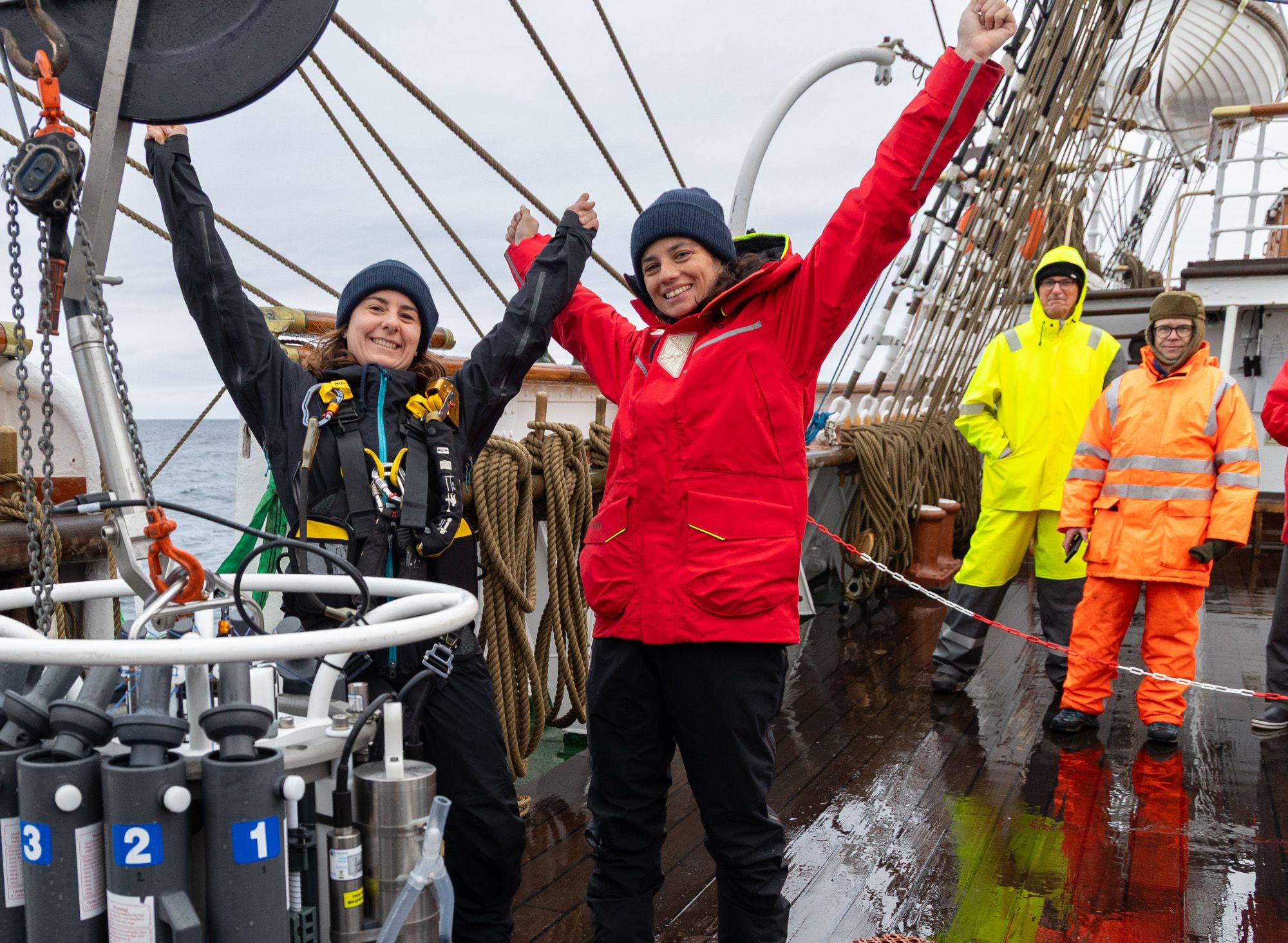
Every third day, the ship would heave to while the CTD was lowered into the ocean. On its descent, it continuously recorded salinity, temperature, pressure, oxygen levels, and other parameters.
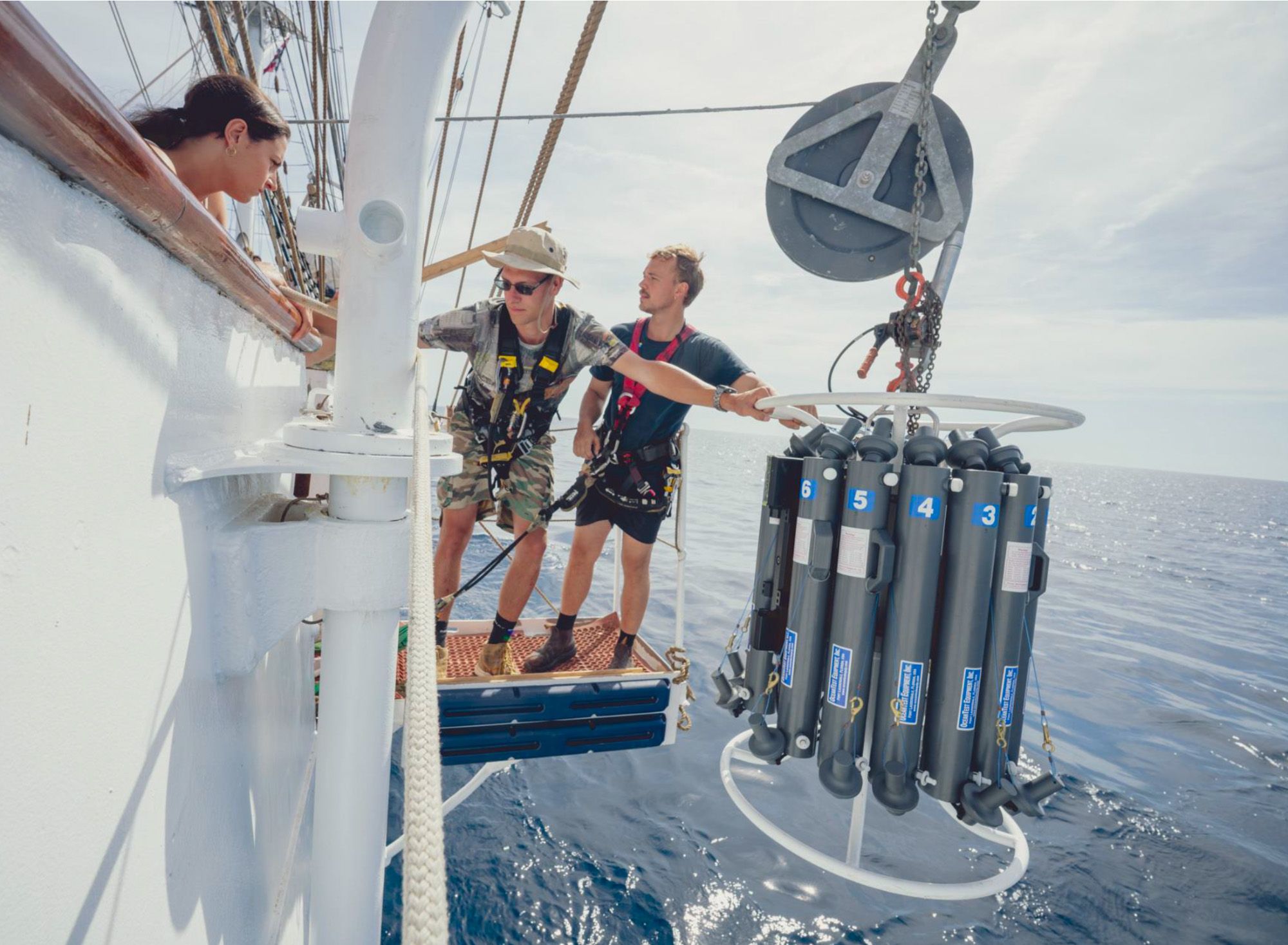
The "rosette" being launched. Photo: One Ocean Expedition
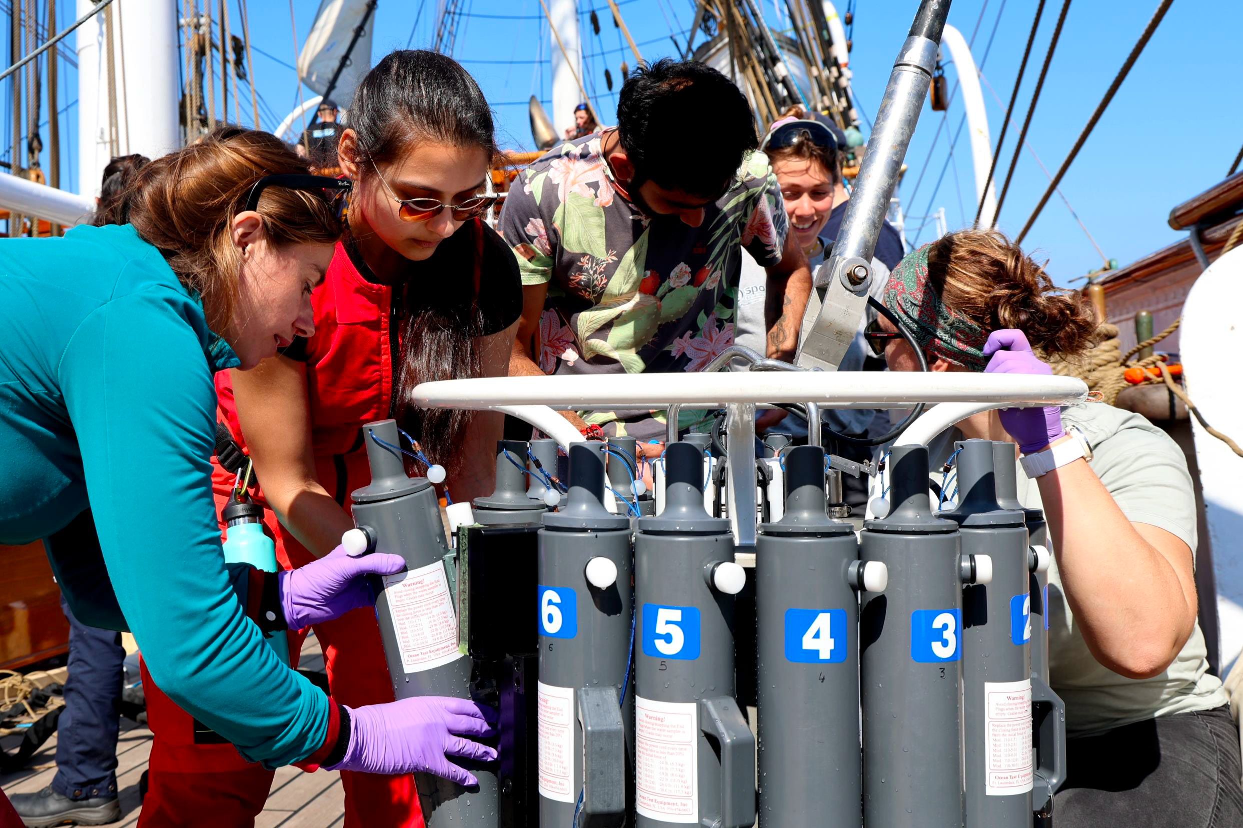
Back on board. Photo: One Ocean Expedition
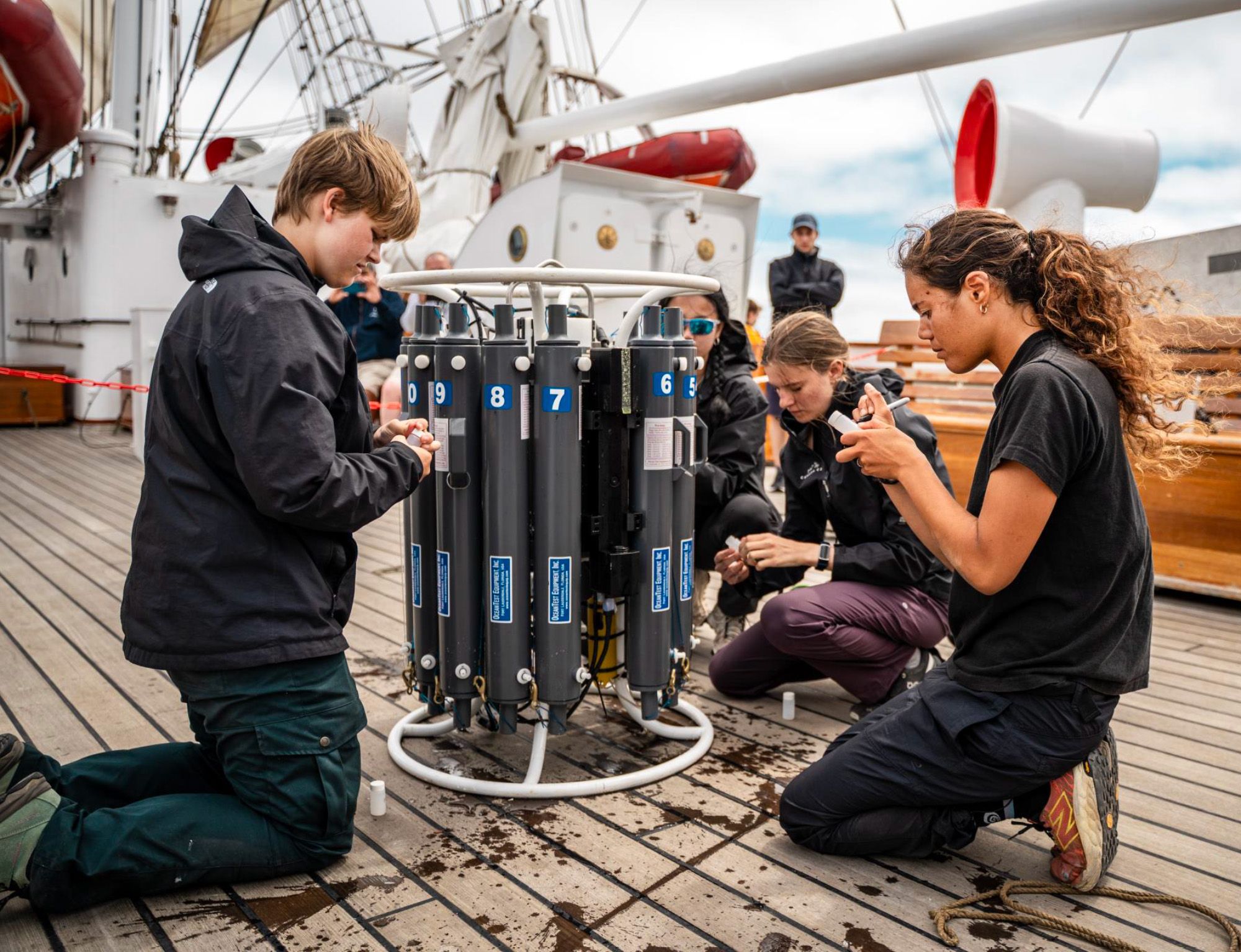
The bottles are emptied. Photo: One Ocean Expedition
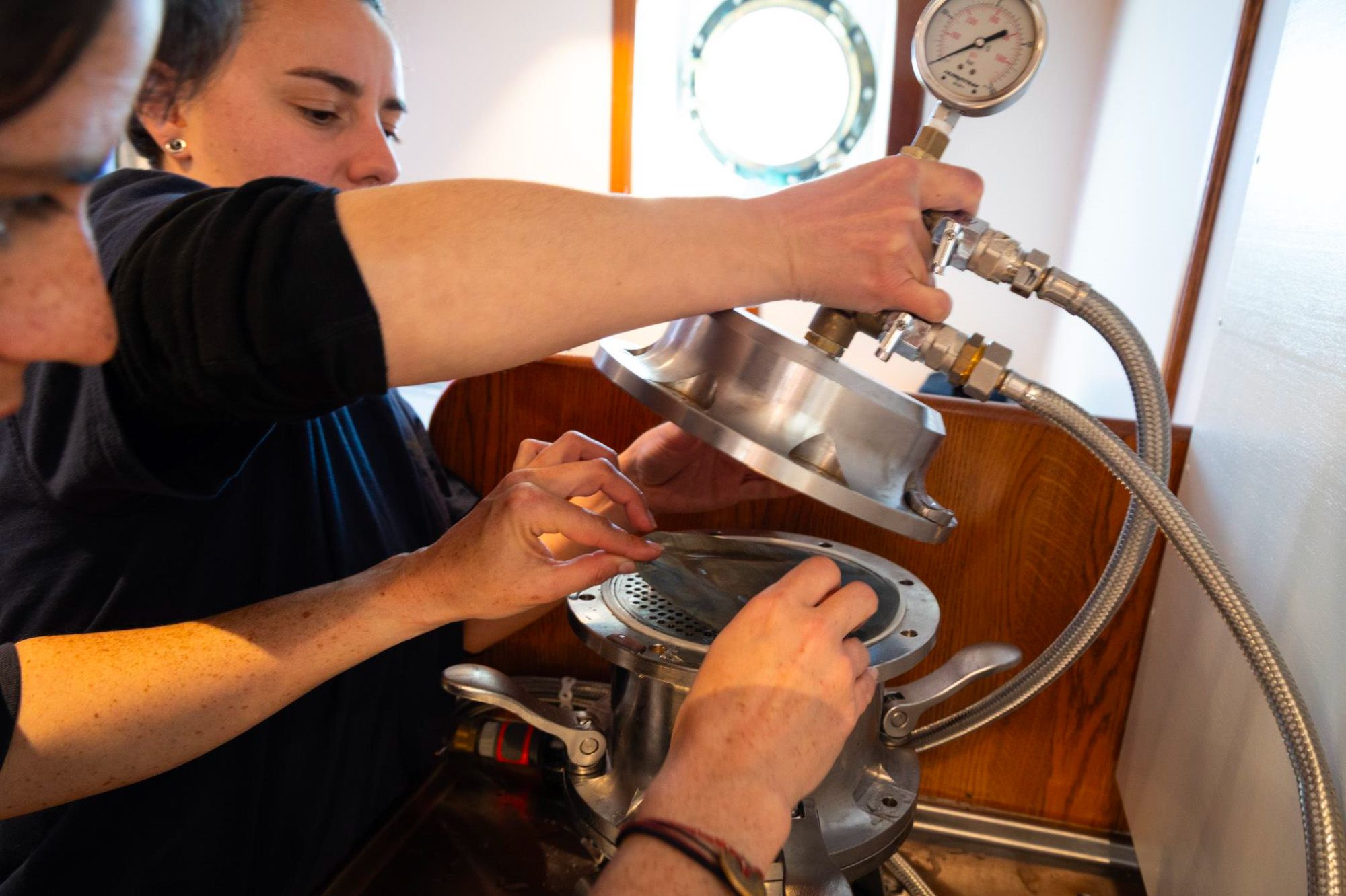
Surrounding the sensors is a ring fitted with long sampling bottles, giving the instrument its nickname: “the rosette.”
– These bottles can be opened at different depths, remotely controlled from the surface, allowing us to collect water samples. That provides information about nutrients and DNA and more, revealing which organisms live there, says Pedersen.
A smaller CTD was used during the previous expedition.
– A compact version we handled with a simple lobster trap hauler. The one we have now is enormous, and suspended from a 1,500-meter cable - allowing us to sample much deeper than before. That required installing a large winch on deck, though we’ve managed to integrate it quite neatly, he adds with a smile.
Measuring using sound
Another major upgrade is what Pedersen calls current-profiling sensors.
– These are acoustic instruments that send out beams of sound in multiple directions, and record the echoes from particles in the water. By measuring the Doppler shift, we can determine current speed and direction.
The Doppler effect is familiar from everyday life: as a siren approaches, the sound rises in pitch, then drops as it moves away.
– This effect allows us to measure current direction and strength from the ship down to several hundred meters, says Pedersen. The sensors operate continuously and represent a significant leap forward - making the ship far more attractive for research.

The vessel is equipped with two such sensors: a high-frequency system reaching about 100 meters, and a low-frequency system reaching several hundred meters, though with lower resolution.
To house the current-profiling sensors, a structure known as “the fish” was installed in the keel - a streamlined blister beneath the bow.

The “fish” also contains echo sounders. These instruments use sound waves to detect marine life - from fish to microscopic plankton - revealing their abundance and vertical movements through the day.
– We now have three echo sounders operating at different frequencies, helping us distinguish between organisms. This is a dramatic improvement over before, when we had only one, mounted in an existing hull opening, Pedersen explains.

Listening to the ocean
During the first expedition, hydrophones - underwater microphones - were towed behind the ship to detect whales and human-generated noise.
– It didn’t work very well, Pedersen admits.
The ship’s high stern caused strain on the cable, which broke after only a few legs.
Now, three hydrophones are permanently installed in the “fish.” Positioned to listen in different directions, they allow researchers to determine whether one or several whales are singing.

– I’ve rarely seen this type of setup on research vessels - maybe two or three examples. It’s truly cutting edge, and we are still learning how to use it effectively.
Research coordinators on board
During the first expedition, students were responsible for operating equipment, collecting samples, and conducting analyses - working in a cramped, hot, and noisy lab below deck.

– They did an excellent job, but it took time to learn routines and work efficiently. With even more advanced instruments on board now, we decided to employ two permanent research coordinators, Pedersen explains.
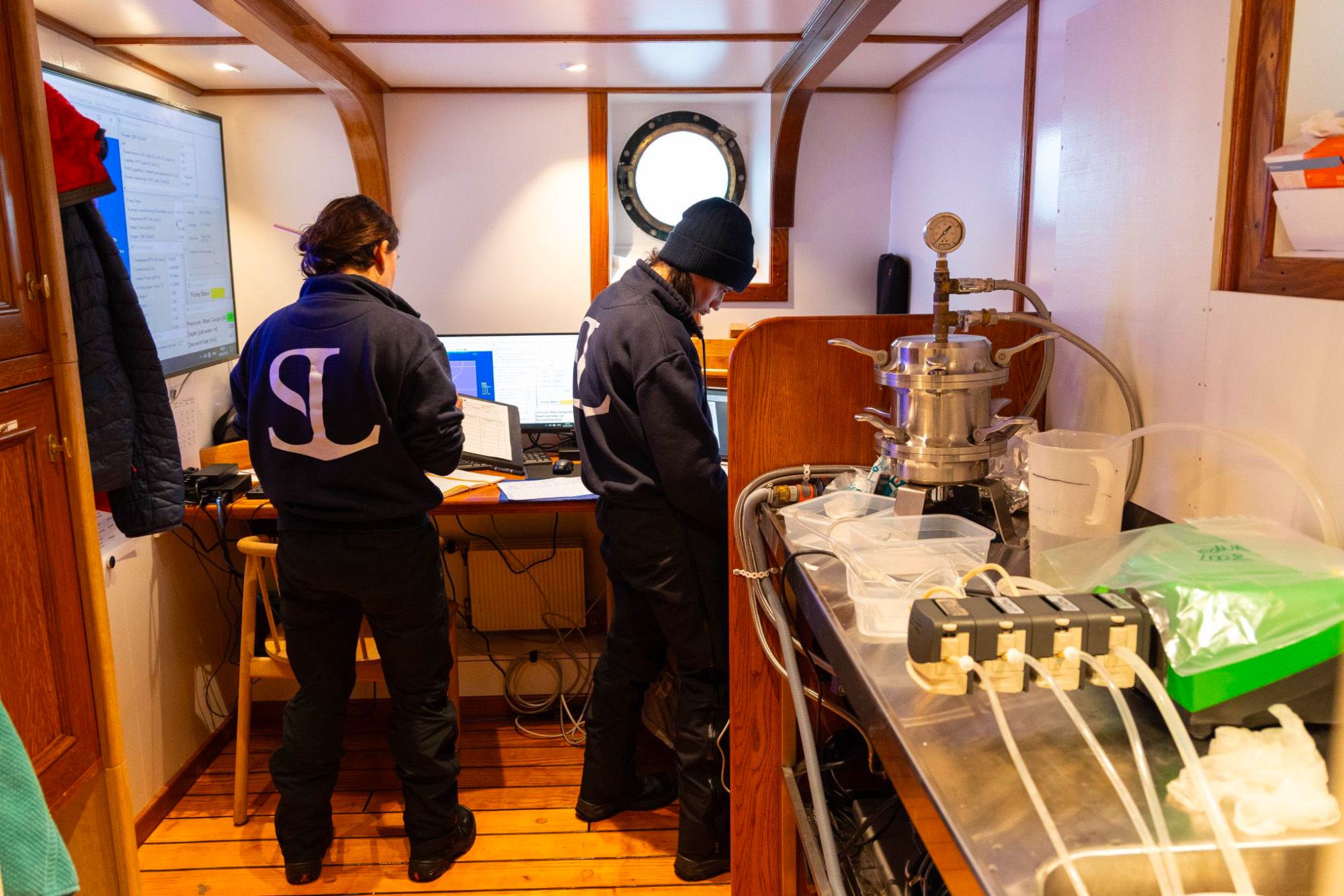
Today, Lucie Cassarino and Natasha Fabregas share these responsibilities. They work in a still compact, but bright and pleasant laboratory.
Lucie Cassarino and Natasha Fabregas. Photo: One Ocean Expedition
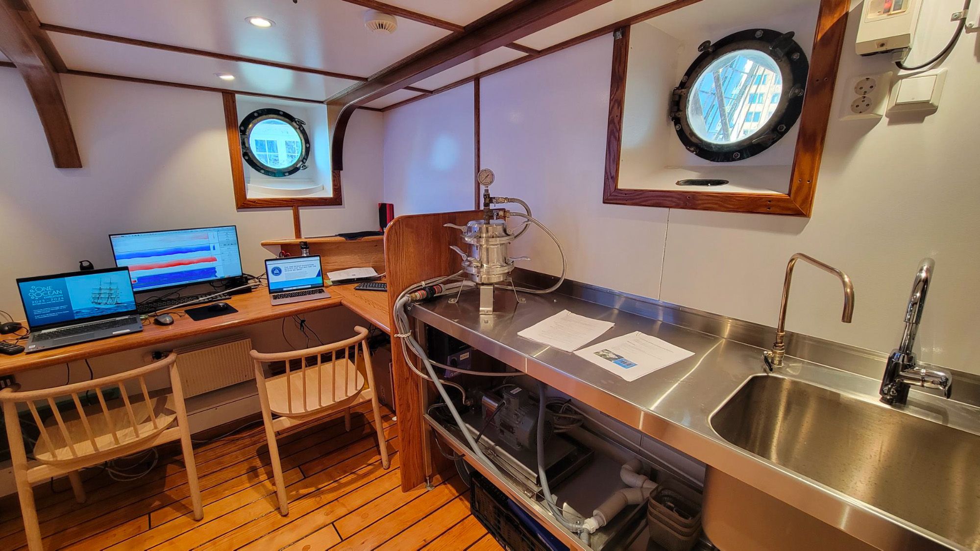
The lab. Photo: One Ocean Expedition
Lucie Cassarino and Natacha Fabregas doing eDNA-analysis in the lab. Photo: One Ocean Expedition
Lucie Cassarino and Natacha Fabregas filtering microplastics samples. Photo: One Ocean Expedition
– Both are French and experienced ocean researchers. They communicate with scientists and students, and also help explain our work to voyage crews and visitors in port.
Dropping some tasks
Some earlier tasks were discontinued, such as scheduled whale observations and systematic fishing with rod and line - often used to estimate fish abundance through “catch per unit effort.”
– Many enjoyed the fishing - it was a great activity - but the scientific value was limited, Pedersen explains.
Whale observations also proved difficult to standardize scientifically, though sightings are still recorded.

A new set of insights
As the second expedition nears its end, the scientific team is left not only with large datasets, but also valuable experience.
What should be improved for the planned 2028 One Ocean Expedition?
– We need to get better at automating data processing, so that the ship can transmit the information we collect continuously to shore, while at the same time allowing students and researchers on board to use the data, especially from the more complex sensors. Not everyone can spend a year learning how to process complex datasets. That’s something we need to work on, Pedersen says.

The long lines
Research vessels operate across all oceans, so in that sense, Statsraad Lehmkuhl is not unique. What sets this expedition apart are two key factors: students and experienced researchers sail together, and the ship collects continuous data along long transects across vast ocean areas.
These long lines are especially important for scientists studying the mesopelagic zone.
Stretching from 200 to 1,000 meters below the surface, this layer receives only faint sunlight - insufficient for photosynthesis. Many organisms migrate upward at night to feed, protected by the darkness, and returning to the depths by day.

These species are vital both ecologically and as a potential food resource. There may be as much as 10 billion tonnes of mesopelagic fish - around 95% of all fish in the ocean.
– Understanding this layer is one of the major scientific challenges today, says Pedersen. It exists worldwide - but how does it vary between regions and across latitudes?
The ship’s echo sounders can detect these small organisms, tracking their numbers and movements.
– After this expedition, we now have even more long transects of observations, including new crossings of the Atlantic and in entirely new regions.
A large amount of data was collected automatically and continuously. Below, you can see maps showing where the research coordinators collected some of the manual samples and carried out specific analyses.
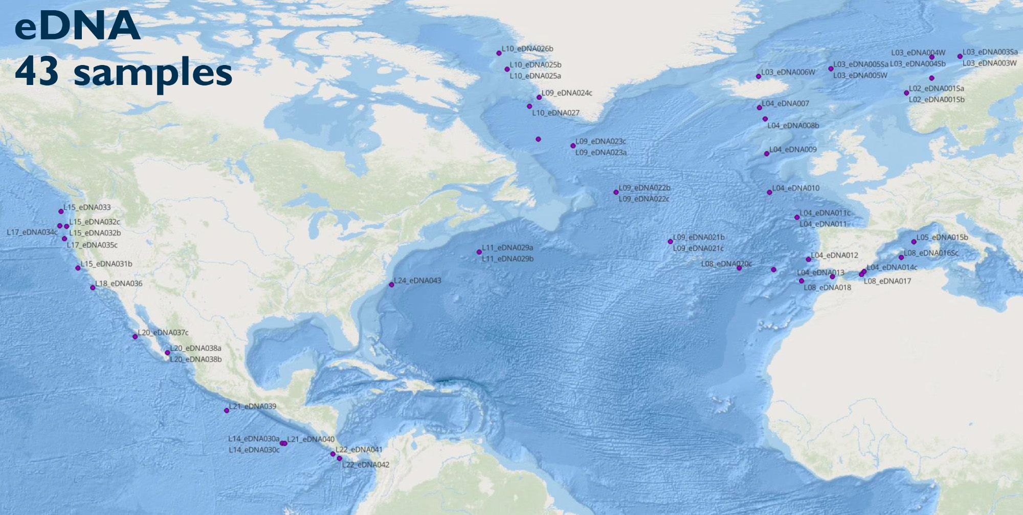
Environmental DNA samples. Map: Natacha Fabregas / OOE
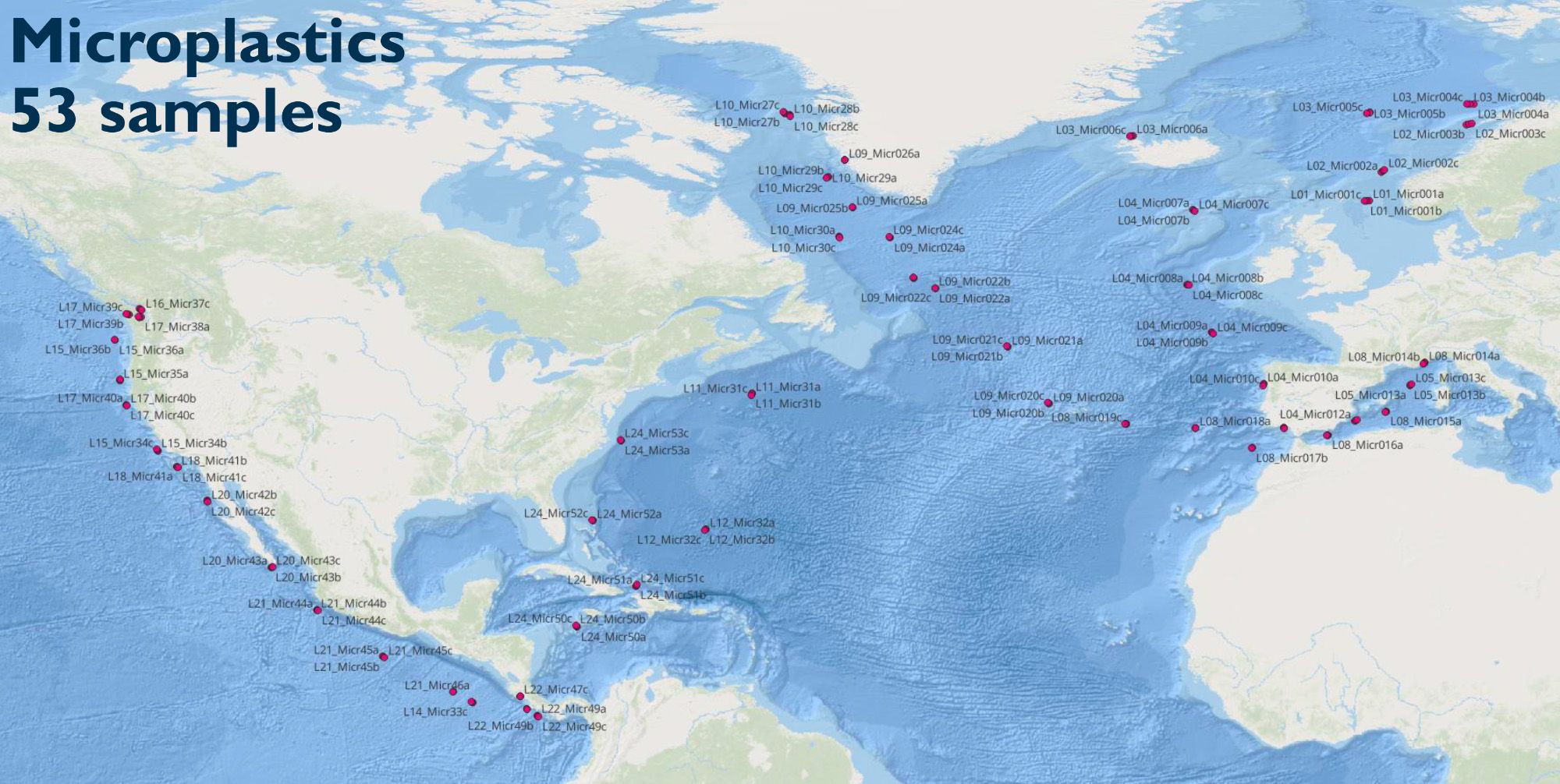
Microplastics samples. Map: Natacha Fabregas / OOE
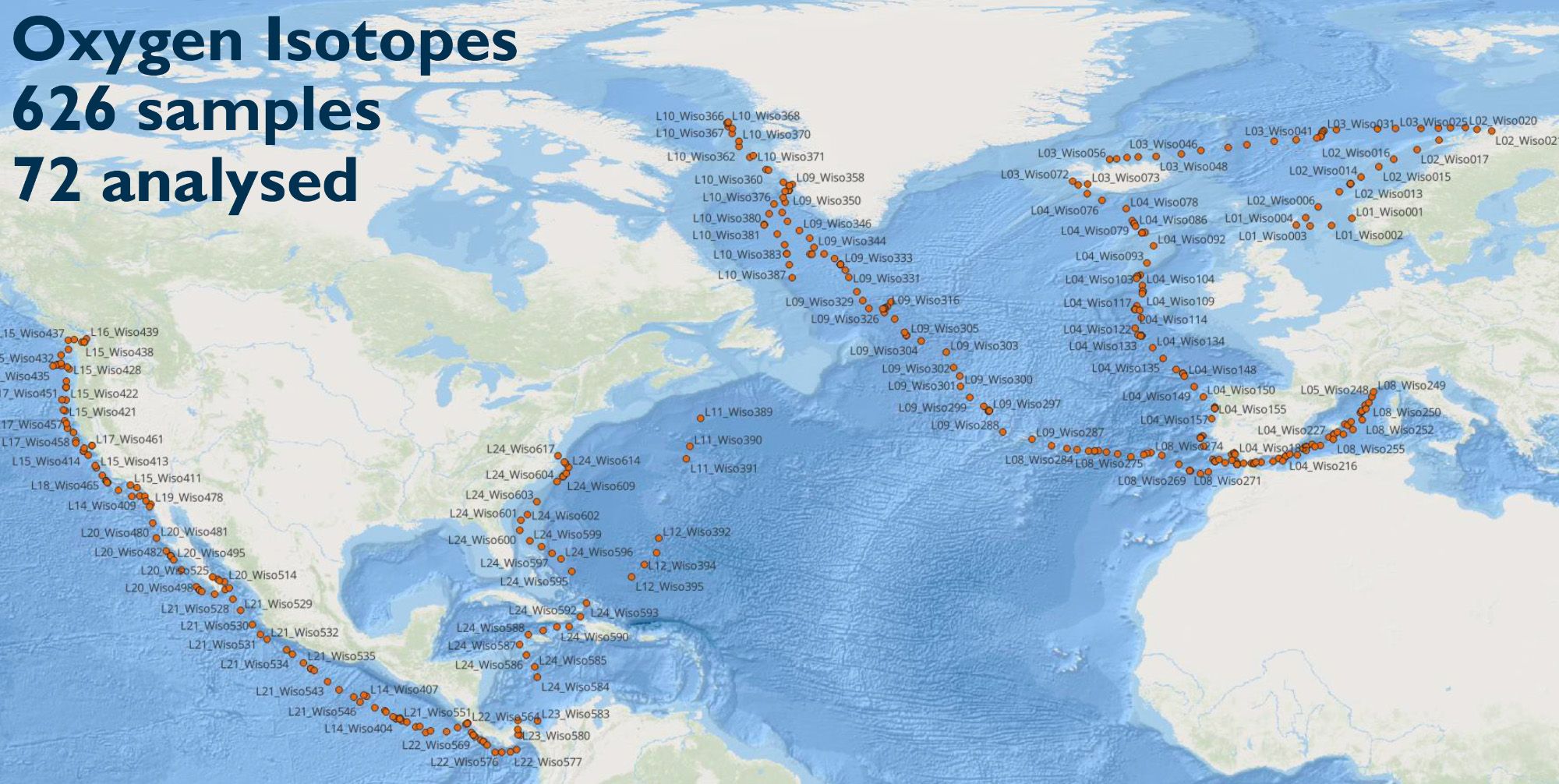
Oxygen isotopes samples. Map: Natacha Fabregas / OOE
The Lofoten Vortex
Researchers are not only interested in long transects. During the leg between Tromsø and Reykjavik, scientists from the European Space Agency, OceanDataLab, and the Nansen Center studied a massive ocean vortex - 60 kilometers wide and one kilometer deep. These vortices play an important role in regulating the climate and influencing marine ecosystems.
The Lofoten Vortex was first identified in satellite images in the 1970s, and has now, for the first time, been mapped in detail in 3D using the ship’s instruments.
This work was carried out jointly by students and researchers.
– Personally, I think this is the most important achievement: giving this extraordinary ship to students and researchers, allowing them to collect world-class data while learning to sail, Pedersen concludes.
– Students collaborate with experienced scientists, build close connections with peers, and form networks that last a lifetime. From this, new researchers emerge, along with master’s theses and scientific publications. Something deeply personal, and one of the greatest outcomes of the expedition.
Looking for data from the One Ocean Expedition? You’ll find it here:


